Tuesday, May 16, 2017

Flying UAS Missions at the South Middle School in Eau Claire and Wetlands in Tomah, WI

Introduction

For our last two labs we flew actual missions with different UAS systems. I. Our goal of this lab is to accurately plan out a mission using GCPs to increase accuracy.

For the first set of missions we flew a community garden at South Middle School in Eau Claire, WI. We first set up GCPs throughout the garden. These were the GCPs we constructed in the previous lab. We made sure to lay the GCPs out in a grid pattern in a logical order. Next we used We used a total station survey tool to tie down the GCP locations to later be used in Pix4D.

Next we got DJI Phantom 3 out and prepared it for the mission. We had a small hiccup and had to wait for new firmware to be installed. This helps reiterated the fact that drones should be fully charged and updated before getting in the field. Next we used the Pix4D mission planning software. We did a preflight on the Phantom and flew the mission. The mission took about 15 minutes and then landed safely on its own. We then packed up and headed home. The data then just need to be processed.

I processed the data. I did initial processing and then attached all the GCPs to the correct locations. I ran the last set of processing and produced the following map.


Tomah, WI

In Tomah, WI we flew a wetland with Menet Aero. We used the Trimble UX5 fixed wing UAS to cover the wetland. This UAS is launched from a catapult system. The UAS can fly around 50 mph.The set up was time consuming but the UX5 is very easy to operate because it is 100% automatic. We just had to continue to watch the drone to make sure that the UAS followed the mission planning software. At the end the UAS comes in for a landing that is a little rough. After all of this we also flew the DJI Inspire. This UAS also followed a mission plan that was smaller then the UX5. The Inspire was easier to set up but had less battery life and was slower. The inspire is all automatic except for the take off that we did manually. Below are images and links to videos of our trip in Tomah. Inspire take off
UX5 Takeoff    UX5 Landing


Monday, May 1, 2017

Constructing GCPs

Ground Control Points are used to get more accurate data. With GCPs you are able to tie the UAS down to the correct location with accurate and precises data. The GCPs are relatively easy to construct.

We constructed them out of 1/4 plastic material. We cut the pieces done into squares and then spray painted them. We use a X pattern to get very precise data. These GCPs are cost effective and because of the plastic materiel they will have a long life.


Friday, April 21, 2017

Mission Planning


Introduction

The Barmor mission planning software allows you to accurately plan a UAS mission prior to entering the field. It also allows for real time corrections. The program accounts for topography and allows you to plan a mission that will prevent you from crashing your drone. In this lab we will demonstrate some of the different types of missions one can fly. 

Overview of Mission Planning

Before using the software you must consider the following items. 

You need to  be familiar with the area. What type of topography and terrain is there? What man made objects are in the areas? Is the area residential? Are there airports near by?
You need to check the weather and check the all of your gear. 
Then make a mission plan.
When you get to the field be prepared to adapt and change your plan as needed. 
Make sure everyone knows there job before the mission.
Review your plan and fly the mission. 

Using the software. 

First you need to select your location. You then can choose which type of mission you would like to plan. You can select a mission by placing way points on the map. You can also select a grid area or corridor missions. You will account for the wind and pick a take off location that goes into the wind. Also selecting a rally point that is near your start area. Then pick a landing site that is away from the take off location. You don't want to get hit with a drone. I like to first pick mission setting as in speed and elevations. 
Figure 1


Here you can select all of your mission setting. I like the relative height feature which allows your UAS to maintain a constant height off of the ground. You will also notice the take off, rally, and landing points in the background of the image. 

Here is a plan for an area based mission. 


Notice the relative flight feature. The drone is taking off and gaining altitude and flies the grid pattern. Be careful planning for the overshoot to avoid hitting the mountains. If your drone will hit the path will be marked in red. You can change this by adjusting which direction the overshoot will be in.


This is an example of a corridor pattern mission that you could fly if you were monitoring a road.


Here is another mission flown over the mountains. Once again you can notice the how the drone is flying relative to elevation.

I also decided to plan a mission over Fairmount Santrol in Menomonee. This could be a useful mission to help monitor their stock piles. The mission setting are also included.


Overview

I enjoyed the software. It has a simple layout feature that is relatively easy to use. There are some features that seem slow and clunky to use. Overall I think it works well and with time it will get better. I also think it has a small learning curve that will also take a little bit of time to learn how to use it quickly and efficiently.

Monday, April 17, 2017

Annotating Oblique Imagery

Introduction

In this weeks lab we will process some oblique imagery taking by DJI phantom 3.The flights imaged three different objects. The purpose of this lab is to get high quality 3D images. We will do this by annotated the UAS data in PIX4D. We will annotated 3 images and I will have an image without annotation for comparison. The images were collected by flying the UAS in a corkscrew patter capturing multiple angles.

Methods

First you need to upload the images to PIX4D. When you process the data make sure you select 3D models for the processing options template.

Next you need to run the initial processing. Once the initial processing is done you will begin to annotate. You need click on rayCloud and then select an individual image from the calibrated camera.
Then you will select annotate. From here you will point and click masking out everything except the 3D image you wish to process. This is a tedious and time consuming process which requires patients. You can hold the mouse down to mask more quickly. I found it is easiest to zoom out to full extent and start by imaging the borders and moving inward and a slow but steady linear movement. You will annotate a few images and then do step two of processing, giving you your completed image. It is best to pick images that show different angles. The more images you annotate the higher the quality will be of your final image.


Results

The images varied in quality depending on how many images you annotated. These are the results for the front end loader without annotations. Front End Loader Before. These are results after the annotations were completed. Front end Loader after annotations. There are some difference with the images but the differences are not profound. Here are the annotated images for the Shed and Tundra.
Annotated Shed and Annotated Tundra

Discussion

I noticed little difference in my annotated images. I annotated 5 to 10 images for both and tried to get variation in angles. To yield better results you would need to annotated more images. I think to get the best results all images would need to be annotated. I noticed that the hydraulic hoses on the front end loader contained  lots of background within them. To get rid of this you would have to zoom in very close to select the pixels to be annotated. I noticed the bottom of bot the front end loader and tundra lacked data which hurt the quality of the final image. The flight path of the UAS would have to be lower to collect data for these parts. I think this would clean up the image greatly. The whole process of annotating is very time consuming. If this needed to be done for your company, I think this would be a good job to out source otherwise all your time will be annotated verses discussing results.


Thursday, April 6, 2017

Calculating Volumes Using Pix4D and ESRI Software

Introduction

This week we will calculate the volumes of stock piles at the Litchfield Site. We will use our previously processed UAS flight data for the Litchfield completed in week 7. We will calculate the volumes using both Pix4D and ArcMap. This will allow us to compare accuracy and efficiency of both methods. Calculated volumtrics can be useful in mines and other applications. It is a quick way to determine how much stock material is left. UAS allows for highly accurate volume calculations because of the spatial detail.

Methods

Pix4D Volume Calculations

First we will calculate the volumes of three piles within Pix4D. This is a simple task and only takes a few minutes. Click on the volumes tab and add a new volume. The on screen directions will explain how to add the new volume. You will find a pile of your choice and click around the pile. Once completed your outline you can select calculate to give you a volume of the pile.


ArcMap Volume Calculation Tools


Next we will calculate the volume of the same three piles but by using ArcMap instead.
We will make use of a few different toolbox operations.
First we will use the Raster Clip tool. This function allows you to clip a polygon out of the raster data set.


Next we will use the Raster to Tin tool. This changes your raster data set to a TIN set. It does not create a better surface, you need ancillary data to do so.


Next we will use the Add Surface Information tool. This tool adds attribute features with spatial information derived form the surface.

The next tool we will use is the Surface Volume tool. This tool calculates the area and volume of region between a surface and a reference plane.


The next tool is the Polygon Volume, which calculates the volume and surface area between a polygon and terrain or TIN surface.

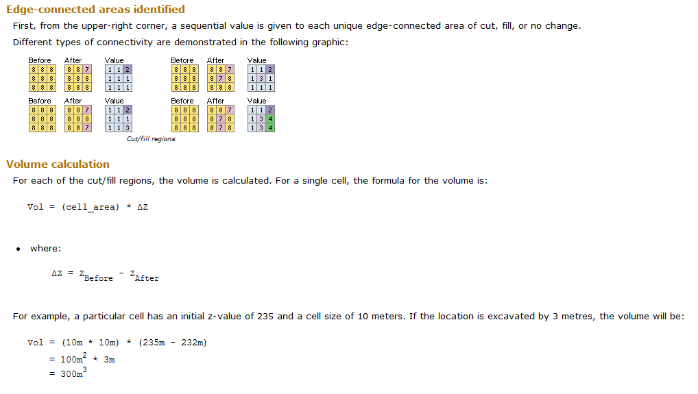
The last tool is the Cut Fill tool. It calculated the volume change between two surfaces.


ArcMap Volume Calculations of the Raster Clips

Open up ArcMap and pull of the Litchfield Map.
You will create three feature classes, one for each pile.


Then you will digitize the piles.


Next you will perform an extract by mask tool using the DSM file. This will give you height measurements to calculate volume.


From here you will perform the Surface Volume tool to create a text box that will calculate the volumes of the piles. Make sure you find out the height at the base of the pile and select the above reference pane. This will calculate the volume of the pile.


Your working model should look as follows. This is an example for the volume calculations of my pile 1. The cut fill uses the Temporal data.


ArcMap Volume Calculations of the TIN

Now we will convert the DSM raster Clips to into a TIN. You will do this using the Raster to TIN tool.


Nest we will add surface information to the TIN files by using the Add surface information tool.


Next we will calculate the volume using the Polygon Volume tool.


The volume will then be added to attribute table of the three polygons you created.
Your workflow should look as follows.


Results


Discussion

UAS platforms are very good tool to calculate volumes if equipped with the correct sensor. We calculated the volumes three different ways. The Pix4D method is the quickest way to calculate the volumes. There is an error associated with the calculation. This method will not yield the most accurate results. The ArcMap methods are also relatively simple to complete and are only a little more time consuming. The Raster method was similar to the Pix4D calculations, The TIN was also similar to the first two methods. The exception was for Pile 1. The most likely reason for this would be very the polygons were created. The Polygons could vary compared to polygons drawn in Pix4D due to human error. This will show slight variation in the numbers. Overall the number were fairly close. This makes me believe that the volumes calculated are fairly accurate to the true volumes. The biggest pro for using Pix4D is the simplicity. ArcMap is helpful becasue one can create a map displaying the data. The TIN method is helpful because the volume is placed directly into the attribute table for the created pile polygons. The UAS can collect valuable data and if processed correctly it can yield accurate volume calculations.

Monday, April 3, 2017

Red Edge Multispectral UAS Data

Introduction

This week we look at the Data collected from a Red Edge Sensor that was attached to a UAS platform. The Red Edge Sensor collects data in five distinct bands. Your able to form a composite image using these bands to form one image. These bands can help determine vegetation health. This can be implemented in farming to better place irrigation systems. It can also be implemented in mining to monitor reclamation of vegetation. The Rededge shoots in blue, gree, red, RedEdge, and near infrared bands. The camera has a resolution of 1280 x 960 pixels.

Methods.

The data collected from the RedEdge sensor must first be processed using pix4D. Your processioning setting should look like this.
Next you will open up ArcMap and create a compositie image combing all five bands using the composite band tool. Make sure you add the bands in the correct order; blue, green, red, RedEdge, and NIR.

After you run the tool open up the properties for the new layer. Here you will edit the symbology to look like this.
Here you can play with the bands to show different forms of the image.
By places selecting 3, 2, 1 you will get a standard RGB composite image.

When you select bands 4,3,2 you will get a False RE image.

And then when you order the bands 5,3,2 you will get a False IR image.


Next we will create a permeable and impermeable surface map using Arcmap Pro. You will follow the steps in the ArcGISpro Tutorial.  Here This will allow you to create a map that looks as follows.

Discussion

The RedEdge sensor is a highly useful when installed on a UAS platform. The False IR and False RE are great for determining the health of vegetation. The areas that are darker red give off more radiation showing healthier vegetation. The False IR is more bright and saturated which would be helpful when looking at large areas. The False RE image seems to show more detail which could be better for looking at smaller areas. These images have practical use in agricultural and mine remediation projects. The impervious map clearly outlines areas that water would not be able to penetrate, roads, roofs. This could help implemented the construction of a drainage system. The drainage system could be constructed more efficiently after analyzing the area with a RedEdge sensor.


Wednesday, March 8, 2017

Pix4D Imagery with GCPs

Introduction

For this lab we will use the Pix4D processing software to process data taken from a phantom drone at Litchfield. We processed this data last week but this time we will process the data using Ground Control Points. This will yield highly accurate Pix4D maps that will create DSM maps of higher quality.

Methods

First you will need to open up Pix4D and at the images you wish to process. Once you have the images loaded into Pix4D you may add in GCPs using the GCP manager.


After you add in your GCPs you need to make sure that your Y coordinates are Northings and your X coordinates are the eastings. You may then do the initial processing of the data. After the initial processing is completed you will notice that the GCPs are not tied down to the ground.


We will now go through the process of placing the GCPs in the correct locations. First go to the Map and click on GCPs until you find point 0. When you click on a GCP it will bring up the GCP manager.


We will then select basic editor to add the correct locations for GCPs. Once you open the basic editor you will go through a few images, 2-5, where you can clearly see the GCPs.


You will point your cursor on the GCP in the image to tie it to this location. You will do this for 4 or 5 different GCPs and then re optimize your image.


After you do this for about 5 GCPs you can reoptimize the image This will allow you to more easily tie down the GCPs. You will have a group of images pop on the left hand side once you select a GCP from the layers column. From here you can correctly place the target on the GCP. You will notice some are close to the GCP but do not directly fall on the target. Once you do two or three you can select automatic marking and it will do the rest of the images for you. You will do this for all the GCPs that fall within the specific flight log.


After you complete this step all the GCPs should be tied to the ground and you can begin the steps 2 and 3 of processing.


After you finish steps two and three of processing you will end up with a raycloud map that has GCPs tied down.


Once you have both projects processed and tied down. You can create a new project that will merge both projects into one. Since the GCPs are all tied down this processing should complete slightly faster. If everything is tied down correctly the maps should perfectly overlay each other and GCPs should be tied down correctly.


Results

The merged DSM file within ArcMap should turn out pretty good if all your GCPs are tied down correctly. The final project will look something similar to figure 1. The map turns out a lot more accurate when compared to the basemap. There are some locations where the data on the maps is skewed. This would be in the south east corner of the map. This is the area of vegetation from the forest so this makes sense as to why the DSM file looks weird here.You notice the highest elevation within the map are areas to the northeast and the large piles of material through throughout the mapping area. The lake seems to be the area of lowest elevation which also makes sense. The GCPs allow us to easily connect separate flights into one data that overlay each other correctly. The Pix4D software seems to be very user friendly. It may be time consuming but easy to use. If you tie down the GCPs correctly you should run into little problems.

Figure 1